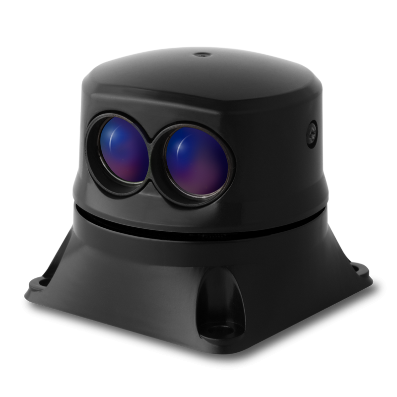


SLAM INTELLIGENCE: The SF40/C is a long-range LIDAR sensor with a time-of-flight range of up to 100 meters. It’s specifically designed for flight applications and provides unmanned airborne systems with simultaneous localization and mapping (SLAM) intelligence capabilities. The SF40/C is also known for its ability to facilitate collision avoidance and low-level maneuvering when used in airborne vehicles and systems.
The device operates off of LightWare Terminal software and has a variety of compatible API integrations available.
Discover the power of long-range optoelectronics with the Lightware SF40/C.
Provides unmanned airborne systems with slam intelligence.
Overview
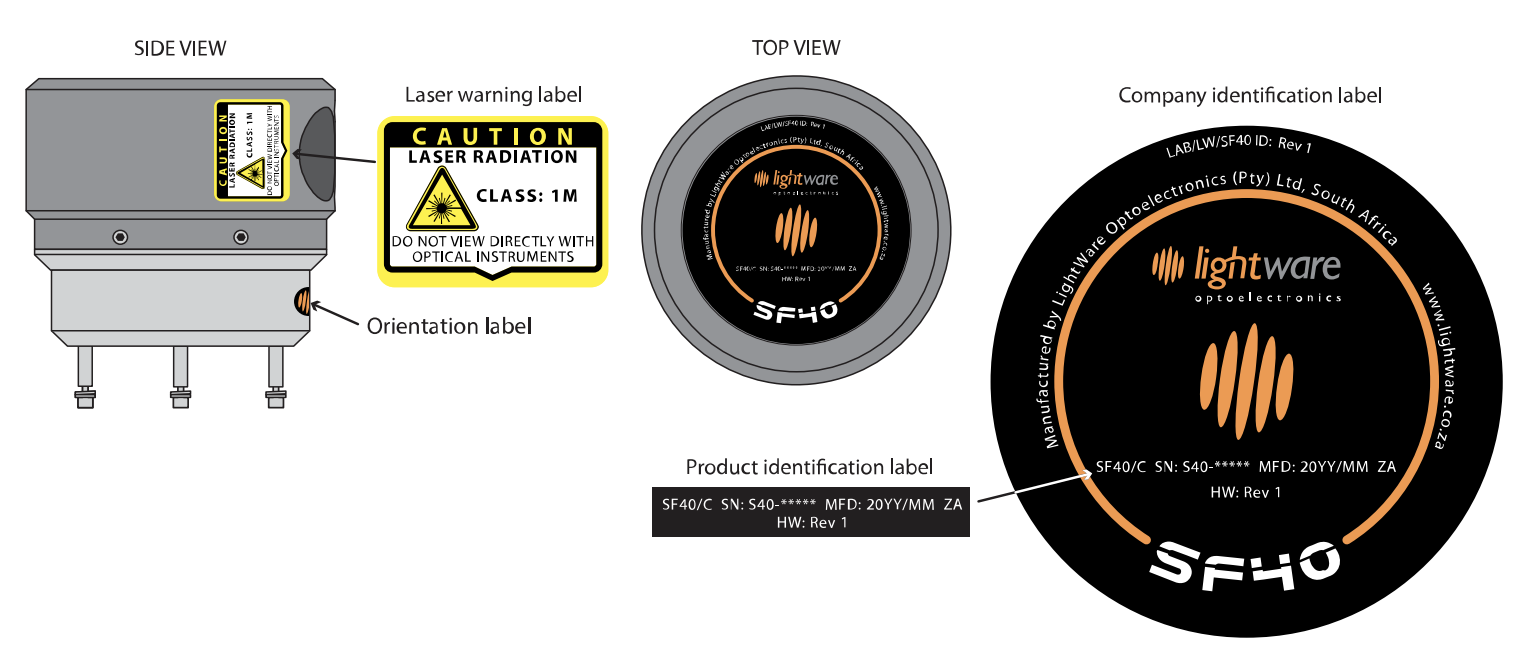
The SF40/C is a laser rangefinder that emits ionizing laser radiation. The level of the laser emission is Class 1M which indicates that the laser beam is safe to look at with the unaided eye but must not be viewed using binoculars or other optical devices at a distance of less than 15 meters. Notwithstanding the safety rating, avoid looking into the beam and switch the unit off when working in the area.
CAUTION -- The use of optical instruments with this product will increase eye hazard.
The SF40/C should not be disassembled or modified in any way. The laser eye safety rating depends on the mechanical integrity of the optics and electronics so if these are damaged do not continue using the SF40/C. There are no user serviceable parts and maintenance or repair must only be carried out by the manufacturer or a qualified service agent.
No regular maintenance is required for the SF40/C but if the lenses start to collect dust then they may be wiped with suitable lens cleaning materials. Make sure that the SF40/C is switched OFF before looking into the lenses.
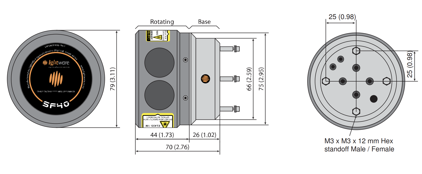
The SF40/C should be mounted using the four holes provided in the circuit board. Do not hold or clamp the lens tubes as this may cause damage and adversely affect the laser safety rating.
Labeling
Dimensions
All connectors and cabling are provided with the unit.
Laser safety is an important issue for all users of laser rangefinders. Please take note of the warning information shown in the manuals and on the stickers that go with every LRF. All LightWare rangefinder products are Class 1M or Class 1, eye-safe.
The Acroname Support Engineering Team can help you decide if the LightWare SF40/C is right for your needs and systems. Support is also available for setup and troubleshooting. Call or email our US-based support team.
- Assist with takeoff, landing and hovering
- Collision avoidence and low level maneuvering
- A "must have" critical UAS component
- Easy to configure using the built-in menus and LightWare Terminal software
- Fully calibrated and ready to run
- Complete with power, interface and micro USB cables
- ISO9001:2008 Certified
Data streaming
Measurement data accumulated by the SF40/C can be output to a host controller for immediate or deferred analysis. The rate at which data is output can be selected as 20010, 10005, 6670 or 2001 points per second.
Alarms
Seven configurable alarms zones can be set within the measuring plane to alert obstacle proximity. Each zone can be set with an individualized alarm distance, angular width and aiming direction. Typically, one zone would cover 360 degrees around the vehicle at close range to alert when people get too close to the moving parts. Additionally, a forward looking alarm zone is used to detect obstacles in the direction of motion. Other alarm zones can check that specific directions are clear of obstructions before course changes are made.
The status of the alarms can be read from the serial port through a command or from the streaming data. Once the SF40/C is running the alarms are updated continuously without the need for any external commands.
Virtual laser range finder
The virtual laser range finder (VLRF) tool is used to find the distance in any direction on the measuring plane. VLRF can assist with keeping station at a fixed distance from a target or measuring how far away an obstacle is. Any number of VLRFs can be created that aim in different directions. This allows for accurate position holding within a confined space and provides confirmation of GPS location using adjacent buildings or other known structures as reference points.
Connector wiring
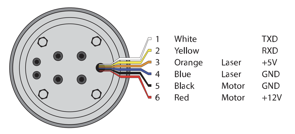
Serial UART (Pins 1 & 2)
- 3.3 V TTL UART
- Supports baud rates from 115200 to 921600
Laser power supply (Pins 3 & 4)
- Power supply should provide 5 V +- 10%
- Power supply current capacity should be at least 0.2 A
Motor power supply (Pins 5 & 6)
- Power supply should provide 12 V +- 10%
- Power supply current capacity should be at least 0.5 A
Mounting on an airframe

| Measuring range | 0.2 … 100 m / 0.6 ... 328 ft |
| Update rate | 20 000 readings per second & up to 5.5 revolutions per second |
| Communication | Serial UART (3.3 V TTL, 5 V tolerant) |
| Operating temperatures | -10° ... 50 °C / 14° ... 122°F |
| IP rating | Unit is IP42 |
| Weight | 261 g / 9.21 oz |
| Dimensions | 70 mm (h) x 79 mm (dia) / 2.8 in x 3.1 in |
| Power supply | 10.8 V ... 13.2 V (Motor) 4.5 V ... 5.5 V (Laser) |
| Integration | ArduPilot, ROS, Arduino, Raspberry Pi and LightWare Studio |

