

Accurate AGL altitude measurements on the ground, foliage, and water
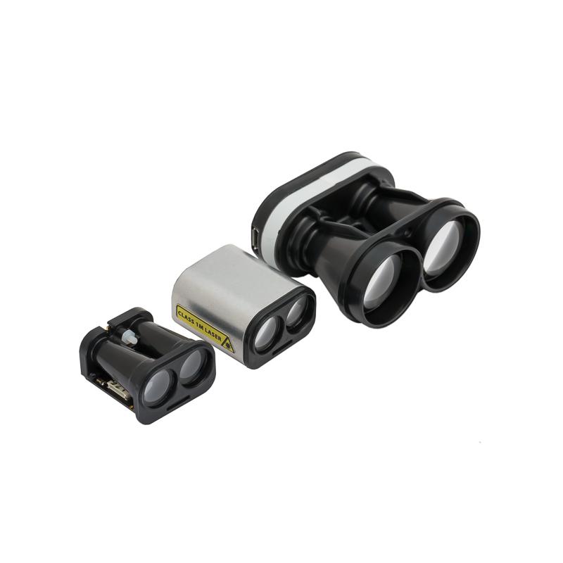
The light-weight SF11 laser altimeter is an essential addition to any unmanned aircraft that needs fast, accurate and reliable AGL altitude measurements. The SF11 laser altimeter makes accurate distance measurements to solid surfaces up to an altitude of 100 meters and water up to 40 meters.
Operating from a regulated 5 V DC supply, the SF11 includes analog, I2C and serial interfaces that can be easily connected to a Pixhawk flight controller or other standard processing platform. Each interface on the SF11 can be configured using a simple software menu that is accessible through the built-in, micro USB port. Settings can also be changed in situ using the command sets available for the serial and I2C ports.
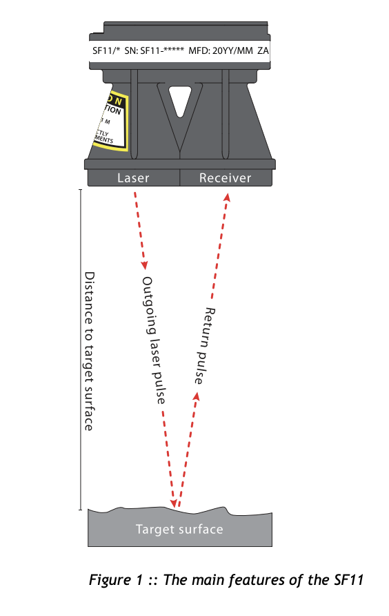
The SF11 works by measuring the time it takes for a very short flash of laser light to travel to the ground and back again. The accuracy of the measurement is not affected by the colour or texture of the ground nor the angle of incidence of the laser beam. The SF11 is virtually immune to background light, wind and noise making it the ideal AGL altimeter for all kinds of terrain.

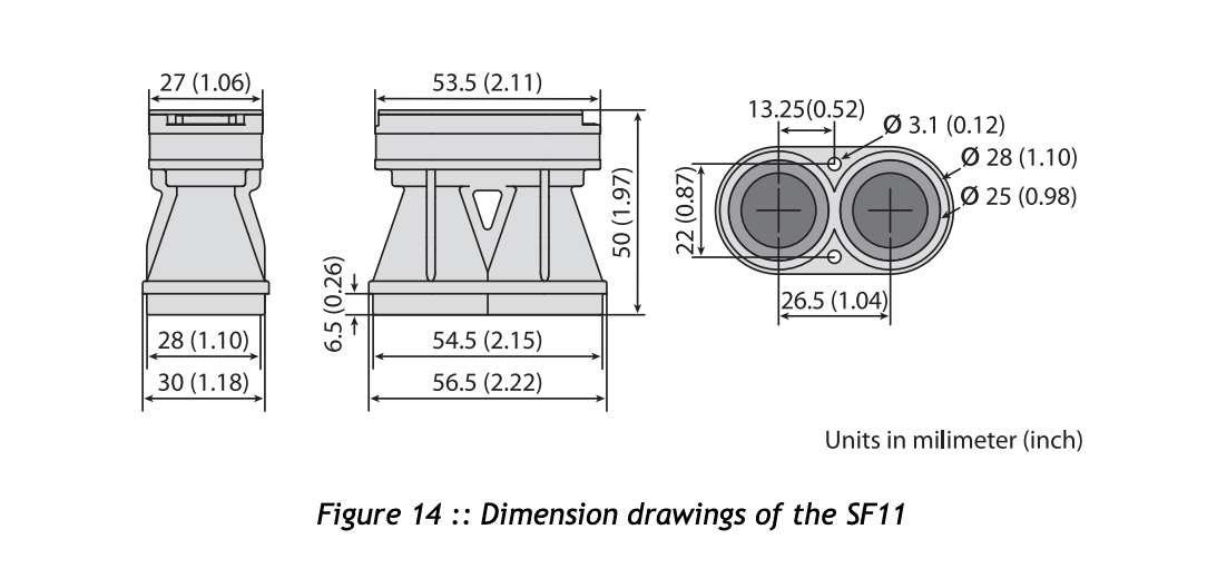
Dimensions
- Compatible with Pixhawk, APM compatible and other flight controllers.
- Very compact and lightweight at only 35 grams!
- Accurate AGL altitude measurements on ground, foliage and water
- Ultra fast update rate of 20 rps (SF11/C) and 40 rps (SF11/B)
- Includes serial, I2C, USB and analog interfaces with programmable capabilities
- Easy to configure using the built-in menu and LightWare Terminal software
- Fully calibrated and ready to run
- Accurate, reliable altitude measurements in sunlight or dark conditions
- Not affected by: speed; wind; changes in barometric pressure; noise; ambient light; terrain or air temperature.
- ISO9001:2008 Certified
- Warning of FAA flight limits
- Precision photography
- Terrain following radar
- Assist with takeoff, landing, and hovering
- Measuring range of 0.2 to 100 m (natural targets)
- Only 56.5mm wide
- Sensor is eye-safe with a Class 1M rating
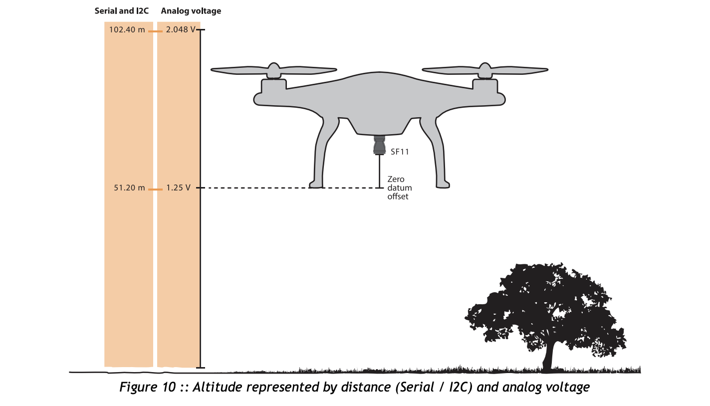
The two analog output selections determine the polarity of the analog voltage. This voltage can be configured to increase with increasing distance or decrease with increasing distance. The increasing voltage option is useful for measuring the height above ground whilst the decreasing voltage option might be used to measure the clearance to a roof above the UAV.
| Characteristics | |
| Weight | 29.96 g; 1.06 oz |
| Range | 0.2 ... 100 m; 0.6 ... 328 ft |
| Resolution | 1cm |
| Update Rate | 20 readings per second |
| Accuracy | ±0.1 meter (70% reflective target @ 20°C) |
| Outputs & Interfaces | USB, Serial and I2C (3.3 V TTL, 5 V tolerant) |
| IP rating | Unit is IP40, front face is IP65 |
| Integrates with | PX4, ArduPilot, Arduino, Raspberry Pi and LightWare Studio |
| Power Supply Voltage | 5.0 V ± 0.5 V DC |
| Power Supply Current | 200 mA (maximum) |
| Laser Power | 20 W (peak), <15 mW (average), Class 1M |
| Dimensions | 30 mm x 56 mm x 50 mm; 1.2 in x 2.2 in x 2 in |
| Operating Temperature | 0 ... 40°C |
| Approvals | FDA: 1410968-002 (2017/09) |
| Optical Aperture | 51 millimeters |
| Beam Divergence | 0.2 degrees |
| Beam Type | Single beam |
| Connections | Plug & socket, micro USB |
