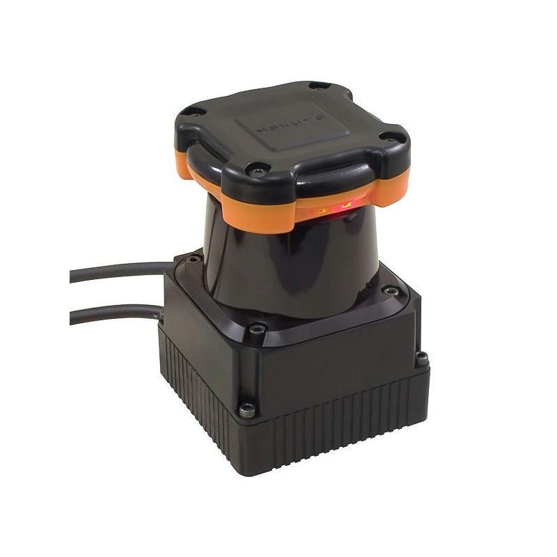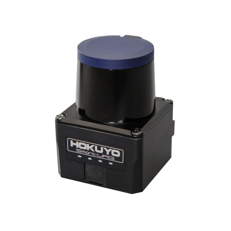
The UTM-30LX scanning laser rangefinder is a low power, small, accurate, high-speed device for obstacle detection.
This model uses USB 2.0 interface for communication and can obtain measurement data in a 270° field of view up to a distance of 30 meters with millimeter resolution. Due to the internal filtering and protective housing, this device can be used outdoors and is less susceptible to ambient light.
Found a lower price? Call and we'll match an identical, in stock competitor's listing.
Advanced Optical Data Transmission Device for Robotic Intelligence
The Hokuyo UTM-30LX-EW LIDAR scanner is an advanced optical data transmission device for robotic intelligence. This device, like others in the Rangefinder series, is incredibly lightweight and size-efficient, making it the ideal “robotics eye” for many modern applications.
Not only is the device well-suited for industrial robotics applications, such as automotive, aerospace and supply chain management, but the technology has also found a purpose in market research applications for behavioral tracking. In this unique use case, subjects’ movements and actions can be tracked within a certain range, without any bias brought on by an in-person moderator or observer. The device uses Ethernet for data communication, communicating optical data from up to 30m away within a 270º field of view. Multi-echo technology makes the UTM-30LX-EW scanner ideal for outdoor environments, providing accurate detection in adverse conditions like rain, fog, snow or dust. For unparalleled 2D environment mapping in all-weather conditions, opt for the UTM-30LX-EW LIDAR scanner.
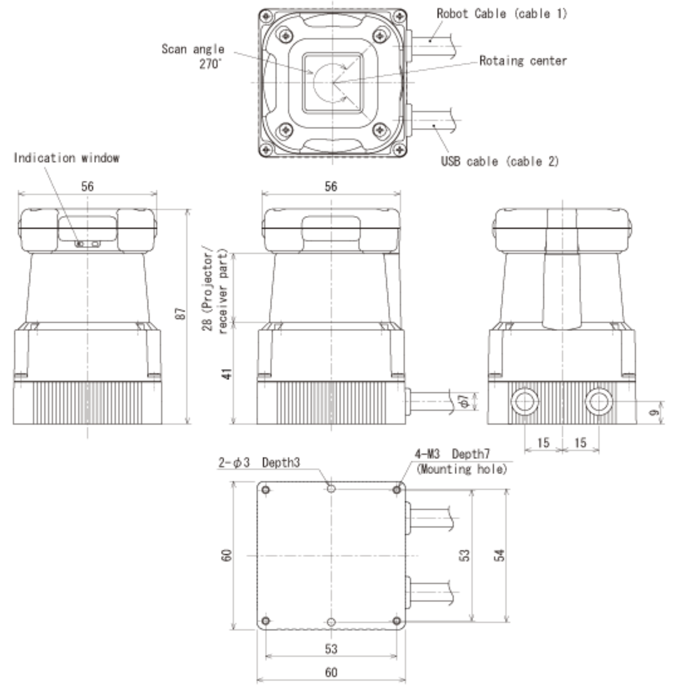
External Dimensions

The Hokuyo sensor includes necessary wiring hardware to interface via a USB connection. `The connector manufacturer and part number is JST PHR-4 on the cable end. Recommended mating options are listed in. Hokuyo's Technical Documentation linked in the Downloads tab. Note: Reversing the power polarity will damage the sensor!
Operation principles
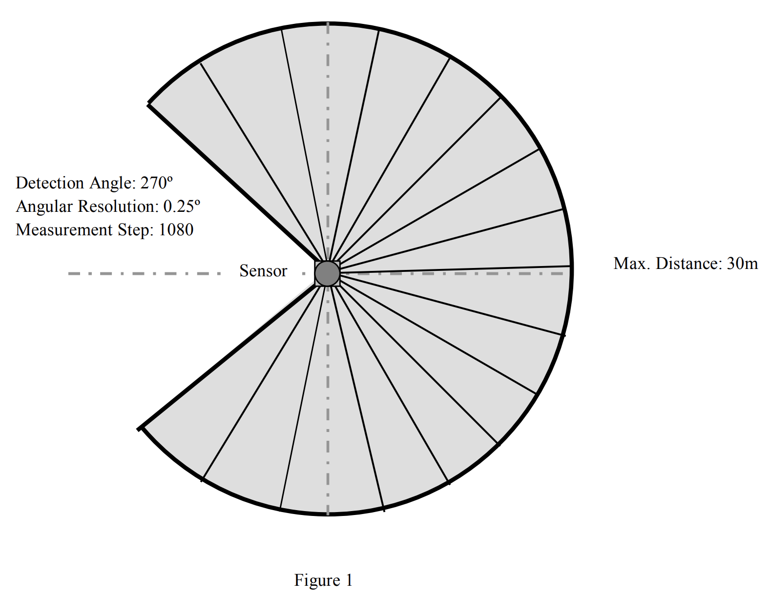
UTM-30LX/LN use laser source (λ = 870nm) to scan 270º semicircular field (Figure 1). It measures distance to objects in the range and co-ordinates of those point calculated using the step angle. Sensor’s measurement data along with the angle are transmitted via communication channel. Laser safety class 1. Sensor is divided into two types depending upon the type of output.
Type
Synchronous output signal is available. The timing chart of this signal is shown in section 6 (Figure 3). This synchronous signal can be obtain at each scan. These are mainly intended for robotic applications.
Diagram of Scanned Area

- Outdoor Environment
- Guaranteed Long Detection Range : 0.1〜30m
- Maximum Range : 60m
- Wide Angle: 270°
- Compact and Light: W60xD60xH87mm, 370g
- Angular Resolution: Approx. 0.25°
- Scan Frequency: 25ms
- Interface: USB Ver.2.0 Full Speed(12Mbps)
- Startup Time: Within 10 sec
- Weight: 370g (With cable)
- Supply Current: 700mA or less (1A during startup)
- Supply Voltage: DC12V ±10%
The Hokuyo UTM-30LX LIDAR scanner is an optical data transmitter for robotic intelligence. It is incredibly lightweight and size-efficient, making it the ideal “robotics eye” for many modern applications.
Use Cases
The device is well-suited for industrial robotics applications, and there are different situations where it can be used.
Outdoor Setting: The scanner is perfect for outdoor environment mapping applications. Its multi-echo technology provides accurate measurements regardless of weather conditions such as rain, fog, snow, or dust.
This advanced device is also designed with a protective casing that helps shield it from harsh outdoor elements while maintaining its stunning accuracy. With this scanner, professionals can quickly obtain detailed 2D maps of any given environment with just one scan.
Autonomous Vehicles: These are yet another application where the UTM-30LX scanner excels. By accurately mapping out obstacles up to 30m away within a 270º field of view, autonomous cars no longer have to rely on conventional cameras or radar detectors to navigate their surroundings safely and efficiently. Through constant monitoring of its surrounding environment for potential hazards like people or animals in its path, autonomous cars can move forward confidently without any operator intervention required.
Drones: Drones equipped with this advanced scanning laser rangefinder have become increasingly popular due to their ability to offer unmatched aerial coverage and data collection accuracy at a relatively low cost compared to traditional surveying methods like satellites or manned aircraft.
With the sensor, drones get more efficient when collecting land surveys and mapping data. Also, they provide unparalleled access to inaccessible locations that would otherwise be impossible or dangerous to reach directly (such as volcanoes or hazardous waste sites).
UST distance measurement
UST demonstration on the data viewing tool.
New outdoor LiDAR : UST-30LX
UST-30LX inherits the excellent measurement capability and the very compact external dimension from the conventional UST series. On top of it, UST-30LX has achieved the maximum measurement distance of 30 meters.
Hokuyo UTM-30LX Lidar
Follow the Gap Algorithm running on F1tenth car using Hokuyo UTM-30LX Lidar
For Outdoor Use
| Characteristics | ||
| LIGHT SOURCE | Semiconductor laser diode (FDA approval, Laser safety class 1) | |
| SCANNING RANGE | 0.1 - 30m, 270° | |
| MEASURING ACCURACY | ±30mm (0.1 - 10m), ±50mm (10 - 30m) | |
| ANGULAR RESOLUTION | 0.25° (360°/1,400 steps) | |
| SCANNING FREQUENCY | 40Hz (2,400rpm) | |
| MULTI ECHO FUNCTION | N/A | |
| COMMUNICATION PROTOCOL | SCIP 2.0 | |
| COMMUNICATION | USB 1.1/2.0 | |
| DI/0 INTERFACE | Scanner synchronous and Failure output | |
| POWER SOURCE | 12VDC | |
| POWER CONSUMPTION | 0.7A or less | |
| AMBIENT ILLUMINANCE | Less than 10,000 lx Avoid direct sunlight as it may cause sensor malfunction. |
|
| PROTECTIVE STRUCTURE | IP64 (1EC standard) | |
| WEIGHT | 210g | |
| SIZE (W X D X H) MM | 60 x 60 x 87 | |

Add New Review